
Curry County History...
Curry County was created on December 18, 1855, from the southern part of Coos County. Initially it was proposed that the new county be name after Captain William Tichenor, council member from Port Orford. However, he declined because his constituents wanted to honor the territorial governor, George Law Curry.
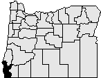
Curry County is situated along the Pacific Coast in the southwest corner of Oregon. It is bounded on the south by California, on the west by the Pacific Ocean, on the north by Coos County, and on the east by Josephine County. The county originally contained about 1,500 square miles. However, boundary adjustments with Coos County in 1872 and 1951 and Josephine County in 1880 and 1927 increased the area to 1,648 square miles.
Upon creation of Curry County, the Territorial Legislature fixed the county seat temporarily at Port Orford until the citizens of the county could determine a permanent site. In 1859, following an informal vote of county citizens during the general election, Ellensburg was designated the county seat. In 1891 Ellensburg was renamed Gold Beach because of the gold and other minerals found in the sands in this area and to eliminate confusion with the city of Ellensburg located in the state of Washington.
The first courthouse was in Judge Fred Smith's home in Port Orford. Apparently the town's inability to finance the construction of a proper courthouse was a factor in the vote that favored the move to Gold Beach. The first courthouse in Gold Beach was replaced in 1912. The current courthouse was constructed in 1958.
The government of Curry County consisted originally of a probate judge, a three member board of commissioners, sheriff, auditor, treasurer, and coroner. The county judge`s position was replaced by a board of commissioners in 1969. Port districts were established at Port Orford in 1919, Gold Beach in 1955, and Brookings Harbor in 1956.
The first county census in 1860 showed a population of 393. There has been a steady increase in population with the 2016 population given at 22,600, a 1.1% increase over 2010.
In 1852 explorers discovered gold and other precious metals in the rivers and along the beaches of this area. Initially settlement in the county was concentrated along the coast and depended primarily on water transportation. The slow development of inland transportation routes kept the county relatively isolated well into the 20th century. While there is still some mining of cobalt, nickel, and chromium in the Gasaquet Mountain area, the economy has reoriented to agriculture and timber. Port Orford cedar (Lawson Cypress) and myrtlewood are important export products. The county has excellent grazing areas for raising cattle and sheep. It also produces blueberries, horticultural nursery stock, and most of the Easter lilies raised in the United States. Vacation and recreational possibilities in the county draw tourists to the area and provide economic diversity.
Oregon Secretary of State