|
Josephine County
Cemetery Driving Directions &
Photos
[click on thumbnails
to view full size photos]
| Dague
Family Cemetery - 633
Scott Dr., Grants Pass, OR
97527. This is a private family
cemetery on private property.
Please ask permission before
going onto the property or to
the grave site. Permission can
be obtained by writing Brittany
Smith or Mr. and Mrs. Dague at
the address of the Cemetery.
Directions: From Grants Pass,
drive south on Williams Highway
(Hwy 238). Before the Applegate
Bridge in Murphy turn left onto
North Applegate Rd. After about
1.5 miles turn left onto Board
Shanty Rd, and after about 1
mile turn right onto Scott Dr.
After a large right hand turn in
the road on the right hand side
is 633. The cemetery is located
in the top left hand corner of
an old cow pasture above a small
pond. The roads are very windy
and get VERY icy in the winter.
Drive carefully. |
| Deer
Creek Cemetery - From
Hwy 199 (Redwood Hwy) just south
of Selma, turn east onto
Lakeshore Dr as if going to Lake
Selmac. Drive about four miles,
and about 1/2 mile past the
lake. Continue on Lakeshore Rd
where it junctions with McMullin
Creek Rd. Cemetery is located
just south of Parker Lane, which
is a connecting road to Deer
Creek Rd. Some information
indicates the cemetery was
created in 1852. No information
as to location of records or
cemetery upkeep or gates. |
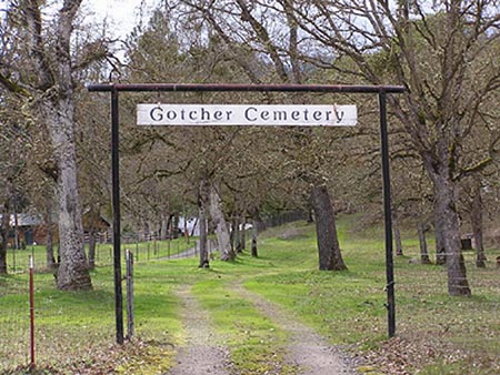
| Gotcher
Cemetery - This
cemetery is located on Water Gap
Road North of Williams. From
Grants Pass, take Highway 238
and head south. About six miles
south of Murphy, take Water Gap
Road (Highway 238 veers left and
Water Gap continues straight).
The Cemetery is about four miles
down, just past the four-mile
marker. It is across from
Sparlin Cemetery. (1890)
|
| Granite
Hill Cemetery - 2551
Upper River Rd, Grants Pass, OR
97526 or milepost 1 on Upper
River Rd. Cemetery hours are
Wednesday through Sunday, 8A-6P,
closed Monday and Tuesday and
may be locked behind a gate
during off hours. Contact the
Josephine County Parks
Department, 541-474-5285,
Monday-Friday, for burial
information and maps. |
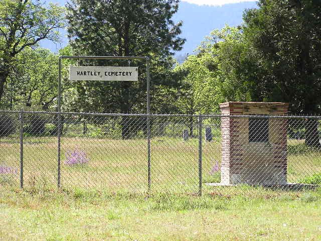
| Hartley
Cemetery (1895) -This
cemetery is located on Cedar
Flat Road near Williams. From
Grants Pass, take Highway 238
and head south. About six miles
south of Murphy, take Water Gap
Road (Highway 238 veers left and
Water Gap continues straight).
Where Water Gap makes a "Y" with
Williams Highway, take a right.
At the Williams County Store,
the road makes another split. Go
straight, and you are now on
Cedar Flat Road. The cemetery is
on the right, just past the 1
mile marker. It is straight
across from house #1161.
Contributed by Saira
Ehlers
|
| Hawthorne
Memorial Gardens - 2500
Upper River Rd, Grants Pass, OR
97526 or milepost 1 on Upper
River Rd. Business hours phone
541-476-5203, or evenings and
Sundays call 541-476-4095.
Hours: Monday through Friday
9A-5P. Cemetery does not appear
to be locked during off hours. |
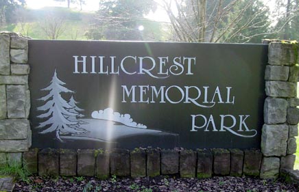
| Hillcrest
Memorial Park - 945
NE Hillcrest Dr., Grants Pass,
OR 97526, 541-476-2310, after
hours and weekends call
541-474-4716. Hours:
Monday-Friday are 9:00 am to
5:00 pm. Saturdays by
appointment.

|
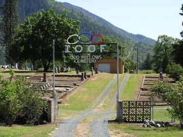
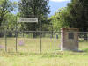
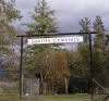
| I.O.O.F.
Cemetery - Located
on Foothill Blvd. Directions:
From I-5 exit 55 or the Grants
Pass Parkway, turn west onto
Agness. Follow Agness to
Foothill Blvd and go south .4
miles. Cemetery is on the right
(west side) and is directly next
to the Masonic Cemetery. Office:
101 SE H St., Grants Pass, OR
97326,541-476-3373. Contact is
Lloyd Siewig, PO Box 553,
Merlin, OR 97532, 541-476-9064.

Photograph by
Saira
Ehlers and used with
permission.
|
| Laurel
Cemetery Association - 1090
Laurel Rd., Cave Junction, OR
97523, 541-592-6990. |
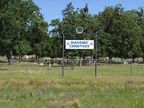
| Masonic
Cemetery - Located
on Foothill Blvd. Directions:
From I-5 exit 55 or the Grants
Pass Parkway, turn west onto
Agness. Follow Agness to
Foothill Blvd and go south .4
miles. Cemetery is on the right
(west side) and is directly next
to the I.O.O.F. Cemetery.
Office: Masonic Temple, 320 NW E
St., Grants Pass, OR 97526.
Office hours are Tues and Thurs
from 11A to 2P, 541-476-3357.
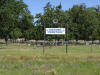
Photograph by
Saira
Ehlers and used with
permission.
|
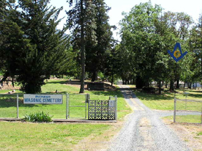
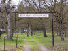
| Masonic
Pioneer Cemetery

Photograph by
Saira
Ehlers and used with
permission.
|
| Missouri
Flats Cemetery - From
Grants Pass take Hwy 238 south
towards Murphy. Just before the
bridge over the Applegate River
turn left on North Applegate
Road (aka Upper River Road).
It's about 4 or 5 miles to the
cemetery which is on the left
and possibly unattended. |
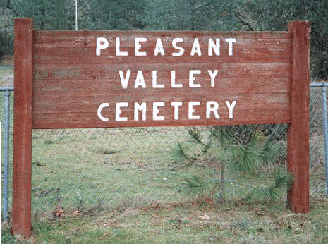
| Pleasant
Valley Cemetery - Directions:
North of Grants Pass, exit I-5
at the Merlin exit (exit 61). Go
westbound on Merlin Rd and turn
right (northbound) onto Monument
Rd (controlled intersection).
Travel 3.5 miles on Monument Rd
and then turn east (right) onto
Schoolhouse Creek Road. Cemetery
is beyond the gated fence, which
reportedly is always unlocked
and open. The road is gravel and
circles and winds through this
mostly unattended and overgrown
cemetery. It is an active
cemetery with between 100 to 500
interments on 20 acres. There is
a part-time sexton, unknown who
or how to reach him.
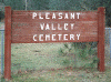
|
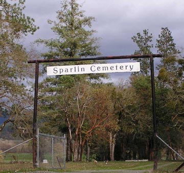
| Sparlin
Cemetery - This
cemetery is located on Water Gap
Road North of Williams. From
Grants Pass, take Highway 238
and head south. About six miles
south of Murphy take Water Gap
Road (Highway 238 veers left and
Water Gap continues straight).
The Cemetery is about four miles
down, just past the four-mile
marker. It is across from
Gotcher Cemetery. (1861)
|
Return to
Cemetery Index
Return
to Home Page
This
page was last updated on -04/26/2013
Compilation
Copyright Linda Blum-Barton
2008 to
Present - All Rights Reserved.

|