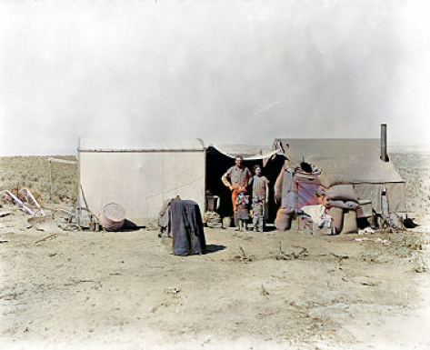
Welcome to Malheur County ORGenWeb


This 1936 photo shows a homestead family in their temporary camp on land in the Vale Project, Oregon.
The family had arrived nine days earlier. Note they are ready to begin farming - you can see a plow and hand rake
in left foreground of the photo.


My name is  Bob Jenkins and I am the Malheur County Coordinator. 

  We have many genealogical resources available here.

  We would appreciate any contributions you would like to  make to this site.
 
  
   Use the box below to search for
   Malheur County Data


 Brief History:

 Malheur County was created Feb. 17, 1887 from the southern part of Baker County. It was named after the Malheur River
 flowing through the area. Peter Skene Ogden, a Hudson's Bay Company trader, referred to this river in his journal as
 "Riviere au Malheur" which translates as "unfortunate river." It was given this name because during an expedition into the
 Snake River country in 1825-1826, property and furs hidden in the area were discovered and stolen.
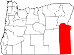
 Malheur County is located in the southeast corner of Oregon. It is bordered by Baker County on the north, the State of Idaho
 on the east, the State of Nevada on the south, and Harney and Grant Counties on the west.


Visit neighboring counties by clicking their link below
 Baker
 Grant  Harney
 Payette, Id  Canyon, Id  Owyhee, Id
Humboldt, NV


   State Coordinator: Bob Jenkins  
         Assistant State Coordinator:
Martha A. Crosley Graham


©   ORGenWeb    All Rights Reserved.                            This page last updated: